PART III. DESCRIPTION OF THE SITE
AND METHODOLOGY
III.1 DESCRIPTION OF THE
SITE
III.1.1 Site location
The study was conducted in CENTRAL PLATEAU agroecological
zone. The altitude characterizing this zone is ranged between 1500 and 2100m,
annual rainfall between 1000 and 1600mm that increases as the altitude
increase. The optimum temperature is about 19oC with minimum of
10oC and maximum of 30oC.
This area is characterized by two major seasons: short rainy
season (September to December) and long rainy season (February to May). Mixed
cropping and rotation practices are well known practices in the area. The
important crops are cassava, sweet potato, banana, bean, sorghum. Coffee is the
main cash crop. Animals available are cattle, goats, pocks and chickens. Those
animals are source of manure but suffer lack of pasture. Predominant trees are
Eucalyptus, Grevillea, Mearnsii, Avocado, pinus, Euphorbia, Callitris, Ficus,
and Markhamia (Djimde, 1988; Niang & Styger, 1990).
III.1.2 Climatic data
Climate data for former Butare province and Simbi District are
lacking and not available at the Meteorological service. In order to have a
picture of climatic variation at the study area, we used averages of climate
data compiled over two decade (1969 to 1993). Averages calculated over more
than 20 years are acceptable and representative values for major weather
parameters such as temperature and precipitation. The following is the table
showing average climatic variables of the region at Ngoma station (Altitude of
1760m, Latitude of 020 36', Longitude of 0290 44').
Table 1: Climatic
data of Ngoma station
|
Temperature (0C)
|
Rainfall (mm)
|
Sunshine (hours)
|
|
January
|
19.51091
|
114.964
|
192.433
|
|
February
|
19.68526
|
108.48
|
154.72
|
|
March
|
19.74687
|
138.476
|
174.3
|
|
April
|
19.43913
|
215.06
|
162.925
|
|
May
|
19.40409
|
125.972
|
167.96
|
|
June
|
19.31527
|
29.625
|
210.033
|
|
July
|
19.49118
|
7.20
|
258.2
|
|
August
|
20.42514
|
33.8
|
234.95
|
|
September
|
20.23218
|
81.07917
|
189.4
|
|
October
|
19.77827
|
121.9583
|
170.425
|
|
November
|
19.09923
|
146.333
|
165.54
|
|
December
|
19.20459
|
113.9833
|
163.6
|
Source: MININFRA 2007
The temperature varies from 19oC to 20oC
that is in the range of temperature recorded within Central Plateau
agro-ecological zone while precipitations levels varies with the major four
seasons mentioned above, maximum values recorded around April and minimum
values recorded around July in the middle of dry season. Soil types are sandy
(known as Urusenyi in local language) in valley and red lateritic (known as
Inombe as local language) in upland (ISAR, 1991)
Administrative map of Huye District
STUDY AREA
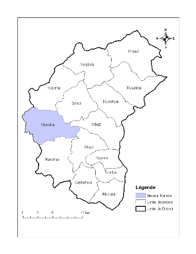
Figure 1. Huye district map and study
area, Maraba sector
| 

