Impact of the type of the cross sectional profile on urban zones roadpar Moise Edgard OBOUNOU ASSOUMOU University of Bamenda (ENSET Bambili) - DIPET II (Diplome de Professeur de l'enseignement Technique II e grade) 0000 |

2.3. Description of the instruments of researchIn order to carry out the collection of relative data to the creation of a suitable and adapted model of study, it will have been necessary the use5(*)of various and different instruments according to whether needs data relative to a precise field. Thus with regard to thetechniques of collection of variables of traffic, theprincipal source of data of traffic is the collection by equipment indicated under the generic term of sensors. In general, they are elements sensitive to a physical quantity: speed, the presence, or passaged' a vehicle. We distinguish: 2.3.1. Pneumaticsensors
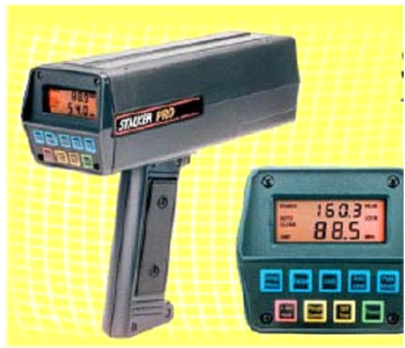
Figure 2: A pneumatic sensor for automatic countingSource: Cours de route 2006 Université d'Orleans I.U.T de Bourges This type of sensor consists of a rubber cable tended across the roadway and connected to a detector; the crushing of the cable causes an overpressure detected by a pressure gauge actuating a relai: this system thus counts the number of axles which pass (we divides by 2 to obtain the number of vehicles). Easy to pose and autonomous, this system is rather expensive and fragile because it can betorn off by a heavy vehicle, moreover, the error ratecan go beyond the 20% in saturated rate; what seems to us rather enormous: because a variation of a few percentages is sufficient to distinguish a fluid rate from a saturated rate. 2.3.2. ElectromagneticloopsIt consists of an inductive loop drowned in the carriageway surfacing, detecting the variation of the electromagnetic field caused by passaged' a vehicle (metal mass), which results in a «crenel of tension» whose characteristics make it possible to know the length and the time of passage of the vehicle. The installation of two inductive loops close one to the other makes it possible to know the instantaneous speed of the vehicles. The technique of the electromagnetic loops has the advantage of being cheap and robust (important lifespan); its great weakness is the dependence of its reliability to quality of the adjustments and maintenance. 2.3.3. Acoustic detectorsOf current employment in Japan but not very widespread in Europe and in the United States in spite of the facility of their maintenance, these detectors are consisted a directing antenna emitting an ultrasonic wave; part of this wave is considered at the time of passage of a vehicle in the surface of detection of the device; a fraction of this considered wave is collected by a receiver, which makes it possible to calculate the occupancy rate of the road. 2.3.4. Radars with Doppler-Fizeau effectSource: Cours de route 2006 Université d'Orleans I.U.T de Bourges
It is about a directing antenna emitting an electromagnetic wave whose a fraction - after reflection on the vehicle - is consequently collected by the same antenna; the difference between emitted frequency and considered frequency is proportional to the instantaneous speed of the vehicle, which makes it possible to calculate the value of the speed of the vehicle with a precision of about2 km/hfor speeds lower than100 km/h. Concurrently to these techniques of automatic countings, there exist also techniques of countings said «at sight»; we gather under this heading all the techniques based on the vision, natural or artificial, which includes the direct observation in situ, by air photography or via fixed cameras installed at certain places of the infrastructure. In what concern the linear of the roadway system and similar data such the populations of various zones, etc. we will use software of numerical cartography and Geographical Information System in particular ArcGIS™ or Mapinfo™ (which is used by the YCC) in order to obtain data relating to it. Obtaining data on operation of the transport system and the road safety in urban environment, was made possible by the means of the realization of investigation of ground near households and sectorial of the field of the urban transport in particular the taxi drivers, of motor bikes, etc. brief of the various actors and users of the various modes of displacements intervening in the field of the urban transport. Within the framework of our work, it is to be recalled that we much more had recourse to final the diagnosis report of the Plan of Urban Displacement of the town of Yaoundé which comprised already the results of the various investigations carried out at the time of the study. * 5By the consultant at the time of the realization of the investigations necessary to the development of the diagnosis of the town of Yaounde or by us even for a possible investigation the purpose of which would be to confirm or to dispute a data or information provided by the Plan of Urban Displacements of the town of Yaounde. |
|